This pleasant linear walk wanders through gently undulating fields and along quiet lanes leading to the old village of Broom’s Green. You then join the Poets’ Paths for the last section into Dymock where you can catch the Daff at the green or opposite. It is a gentle landscape offering fine views across the Leadon Valley to Marcle Hill and also to the Malverns. The walk is also part of the Slow Ways network-check it out at slowways.org/Settlement/Ledbury
Distance: 6 miles, allow 3-4 hours
Map: Explorer 190 Malvern Hills & Bredon Hill
Grade: Easy walking with few stiles, one diversion along a back lane because of crop obstructions which have been reported to Gloucestershire County Council.
Public Transport: The 232 Daffodil Line serves the start and finish points of this walk at Ledbury Market House and Dymock. Check out bustimes.org.
Refreshment: In Dymock try the Beauchamp , In Ledbury the Prince of Wales or the Market House Cafe.
1. The half-timbered Market House of Ledbury stands defiantly amid the bustle of everyday life and this is where the 232 stops. Continue up High Street to the Top Cross crossroads. Keep ahead, crossing the road into The Southend, passing by an impressive half-timbered house, The Park, dating from the early 1600s. Continue along the pavement and with a tall wall to your left, rising up and past Biddulph Way until you reach the entrance to a tennis club on the left.
2. Cross the road here and follow the path left and then right into a housing area. Go left on Jubilee Close, but at the junction after number 36 go left along a path between 28 and 30 to a kissing gate. Keep slightly left to the wood and the path winds through to another kissing gate. Cross the Leadon Way with care to enter a field opposite.
3. Turn right in the field and then left along the field’s edge. Pass through a gap to enter a pocket of woodland and into the next field where you follow the hedge on the right around to a bridge over a stream. Once over proceed, as indicated by a waymark up a track and across an access road leading to the 18th century Hall House. Continue to follow the hedge on your left leading to a footbridge.
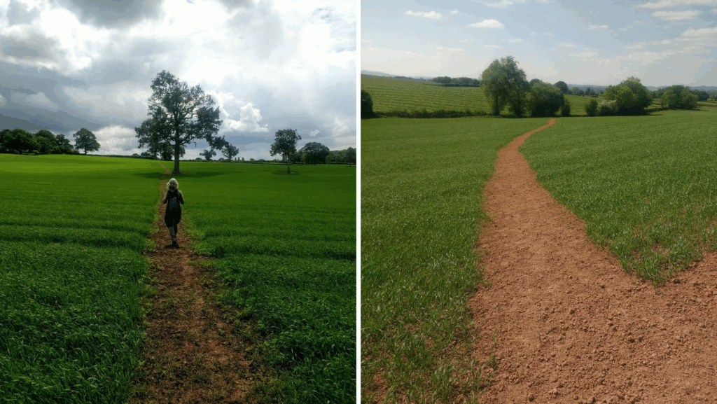
4. Once over go ahead alongside a wood to pass through a bridle gate between two field gates to turn immediately left. Cross a footbridge in the corner and follow the hedge on your right to reach the rear of a garden. Go right for a few metres into the large field and by the oak tree follow the quad bike track slightly left across the field. If this is grown over go along the field edge, but before reaching the wood aim slightly right down to meet a clearly marked path through the crop, running roughly parallel with the field’s edge. There are good views in the field across the low-lying Vale of Leadon to the Woolhope Dome. The path leads to a stile which you cross to walk through a lovely wild flower meadow, keeping well to the left of Nurden farm as signposted to a stile beyond an oak tree onto a lane.
5.Turn left along the lane and left again at the junction to a small group of houses. There’s a VR (Victoria Regina) post box on the left and at this point look for a path on the opposite side of the road by fencing and a drain. Go through the gate, alongside a hedge, over a footbridge to cross a stile. Follow the line of oak trees across the field, over a stile into the next field which happens to be a crop of rapeseed this year, but a path through has been made, and then over a third stile in the next boundary. Continue ahead along the hedge, ignoring the first broken stile as you approach houses at Broom’s Green, but cross the second one into a wood through to a lane.
6. Go right to pass the old shop. Opposite the dwelling ‘Tree Tops’, look for the Poets’ Path II which cuts off left between gardens and over a footbridge. Follow the hedge on the right, through a kissing gate into a meadow. Keep ahead through two gates then right alongside a hedge and you’ll catch sight of May Hill with its distinctive clump of trees from this vantage point. At the junction by a pond shrouded by trees, keep to the left and then ahead alongside a hedge to your right in the next field. The path curves right (ignore the stile on your right) to cross a footbridge over a stream, then climb very slightly left to a stile into a track. However, if the line of path is obstructed by a crop go left along the ditch and then right before the double gates to climb up the hedgerow to climb a stile.
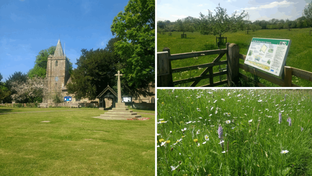
7. Turn right and immediately left again along the lane to descend to a junction. Keep right here and you soon come to Vell Mill nature reserve, a traditional daffodil meadow with the addition of an orchard in the making. Continue along the lane which soon bends left, but ignore the Poets Path II here, by following the lane across the River Leadon at Elm Bridge and ahead until you reach a junction with a lane off to the left.
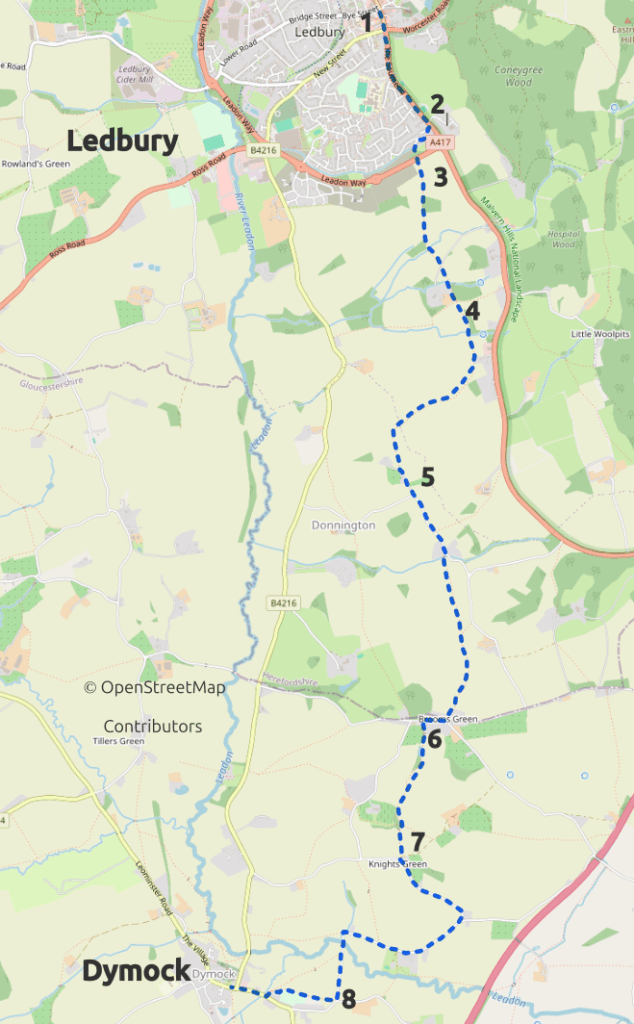
8. Look for steps up on the right to a gate in the hedge to join Poets’ Path I. Keep ahead to reach a kissing gate leading into the cricket club. Go right to skirt the clubhouse and along the perimeter to a kissing gate to exit into a field. If the regular path curving left has not been reinstated follow the hedge line on the left which bends around to a kissing gate and the B4215 road. Cross with care onto the pavement and turn right to walk up to the Beauchamp Arms for refreshment and, of course, to visit Dymock’s church where there’s a superb exhibition featuring the work of the Dymock Poets.